N.°03 beta
Mapa
The normativa for every lot in Maldonado, on a free public map.
02 What it does
Pick a lot, read the rules. No login. Nothing to install.
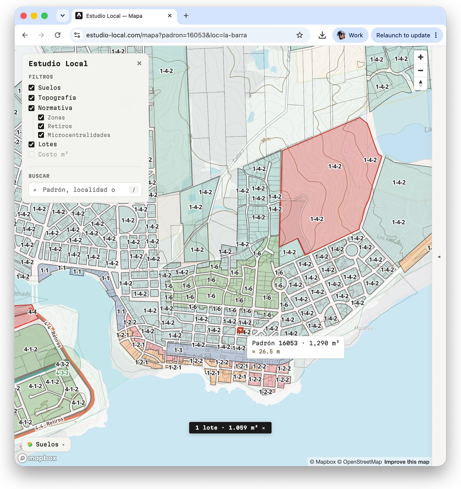
Mapa puts the public record for every padrón in the Maldonado department on one map: 67,488 urban lots and 19,790 rural ones. Search by padrón, locality or zone, pick a lot, and Mapa states what the normativa allows there, quoting the article each rule comes from. Where the normativa is silent, Mapa says so instead of filling in a value. Free, no ads. An ALPA product.
03 What it gives you
i.
Colour the map by what you need
Each lens colours every lot on the map: Normativa (by maximum height or buildable m²), Restricciones, Servicios and Lote. Tick one or more classes to filter the map; the counts follow the view.
ii.
The normativa for each lot
A rail of six tiles sums up the lot. The pane gives the TONE zone with the article quoted, permitted uses, FOS, FOT, height and floors, how each parameter is measured, and the optional regimes that may apply, including expired ones.
iii.
Every source listed
Values cite the Digesto Departamental, and gaps are named, not filled. The Fuentes page lists the 39 public sources behind the map, 12 departmental and 27 national, with publisher, licence and the date each was checked. 12 are on the map today; the rest are marked «En proceso». Terms of use are published alongside.
iv.
Exports for people and agents
Shift-click adjoining lots to add them up. Download the selection as JSON or copy a ready-made prompt for an LLM. Every lot also has a plain page and a JSON file at lotes.estudio-local.com, so an agent can read it without opening the map.
04 By the numbers
87,278
Lots on the map: 67,488 urban and 19,790 rural
13 + 10
Urban localities and rural cadastral sections
39
Public sources listed: 12 departmental, 27 national
$0
No login, no ads, nothing to install
Open the map.
Public. No login. Nothing to install.
Open the map →